
A group of thirteen optimistic walkers were hopeful that we would beat the forecast rain on Sunday July 7th when the Wileman Track and Mount Samaria track were to be navigated. There were incentives presented to not get wet – walk at a moderate pace, don’t break for too long, and navigate correctly. Oh well, as Meatloaf sang, “two out of three ain’t bad”.
Our final parking destination in the state park was the site of the kiln ruins at Spring Creek Sawmill campsite. After some car shuffling, all walkers began the start of the Wileman track from The Back Creek Falls location.
These falls are not far from the Mount Samaria Road, and although little rain had fallen recently, there was the ever so slightly cascading waterfall to be seen, and wonderful views over the lower end of the park. The drive to eventually begin the walk took about an hour and a half, and so morning tea was taken at this location.
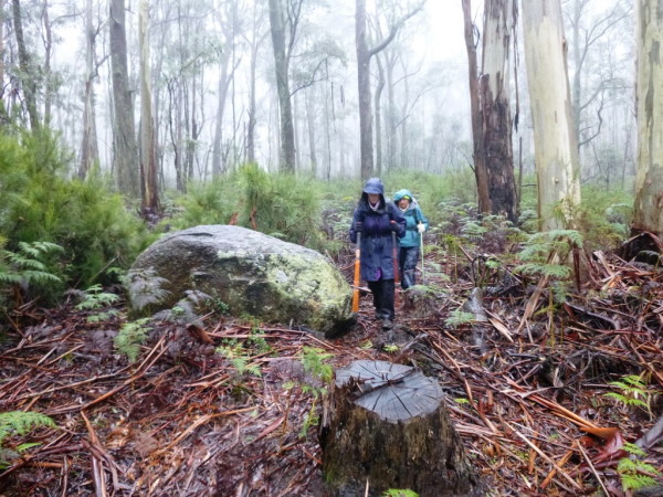
After refreshments, the group continued along the well-defined track. We were fortunate during this part of the walk to be greeted by sunshine breaking through the clouds, and the canopy of trees, on occasion. Bird calls were heard along the way, and Cecily and Geoff both noted the call of the lyre bird.
The facilities at the Camphora Campsite included a welcomed toilet, and simple bush camping amenities. It was a chance to catch one’s breath before moving on, and compare travel notes of those among the group who have visited/about to visit/want to visit Japan.
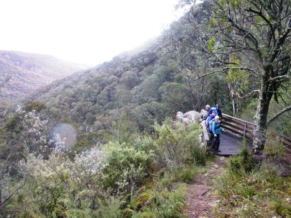
Wild Dog Creek Falls was the next location. The walk to these falls required a little surer footing, and sturdy knees, as the descent required effort for the eventual reward. Once again, a small waterfall was flowing with great views from the observation platform of the surrounding bushland. Retracing our steps, we made our way back to the nearby campsite where lunch was taken.
A check of my rain radar confirmed that rain was inevitable. So, after lunch the wet weather gear made its anticipated appearance. It was at this point the group divided into two. One group would continue to walk the steep link track to Mount Samaria, while the others returned to the car via the Mount Samaria Road.
My estimates for each of these walks put the Wileman Track to the cars at nearly 10km, and the Mount Samaria extension about 14km. If navigated correctly.
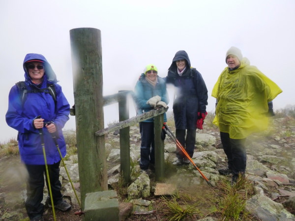
Mt Samaria summit is 953m above sea level. The link track required the group to climb about 170m over a distance of 500m. This was enough to slow everyone down, and generate heavy breathing equivalent to an asthma sufferer having an attack. It was a case of everyone moving at their own pace, and treading carefully, as the steady light rain came.
Reaching the summit though does have its reward on a clear day. Today was not that day. The obligatory photos were taken, and imaginations used as to what might be seen in the far distant horizon. From the summit involved a very cautious walk, down the now more slippery track, to follow the Mount Samaria track back to the cars.
It was at this time an unexpected phone call was received. I missed getting to my phone in time as I couldn’t navigate my way through my layers of clothing and wet weather gear in time. What are usually easily opened zippered pockets now became as impenetrable as Fort Knox.
Once I eventually located my phone, I saw it was a missed call from Cheryl walking with the others back to the cars. Long story short – the conversation ended with “no, you should have turned right at Mount Samaria Road, not left”.
That sorted, it was now like a very meagre Amazing Race episode as both groups raced, well sort of raced, back to the cars.
The Mount Samaria track at times had its challenges. One that comes to mind is where on earth is the track? I used quite a few unprintable adjectives to describe the track to myself.
During the afternoon the group had to climb over several trees, and one of the largest ones had fallen on this section of the track flattening out the surrounding area for quite some metres. At times over rocky sections of the track it was a calculated guess as to where it should be. The sparse orange track markers too often seemed to be posted for walking in the opposite direction.
For today’s walkers this was just like walking in Scotland, where if you don’t like the weather you just need to wait ten minutes. Today we had clouds and part sunshine, fully clouded sky and then some rain. Oh, and here it comes now – a little bit of fog thrown in for more variety as the afternoon begins to disappear towards dusk.
I am sure, had we waited long enough, snow would have fallen. The final descent from Mount Samaria Track was down the Lightning Track. A final delicate bit of walking was mandatory to stay upright, before crossing a small creek and reaching the cars.
The winners of the meagre Amazing Race – the Mount Samaria walkers who ended up walking 17km. I know it’s more than 14km. My inability to calculate accurate walking distances is becoming legendary. And the other group? Well let’s just say that in the years to come the distance they will have meandered will become folklore.
Was it an additional half of the expected distance of 10km? Was it double? Do we just add an extra zero on the end?
Should they become the first inductees into the WRBC hall of fame? Anyway, the whole experience was nothing that Pat’s afternoon tea couldn’t soothe away.
Michael Braendler