A fine and sunny day was on display for the 15 walkers who were intent on walking to Eagle Point and Og, Gog and Magog at Mount Buffalo on Sunday October 20th. But gentlemen. Gentlemen. Where were you all? Colin and I were the only two blokes with the task of accompanying the ladies today. A most demanding assignment.
My car was providing the club’s exclusive taxi service as we picked up Shirley in Tarrawingee and Cath in Myrtleford. Car conversations on route to a walk are often interesting. Sometimes not. Our conversational topics included the imperial and metric systems. Inches, centimetres, metres and even the decimetre rated a mention. Now there’s a useless measurement if there ever was one. Then with the recent rainfall there was the topic of measurements in millimetres, inches and points. I usually cite buckets, downpours, deluges and cats and dogs.
Our drive up the mountain was glorious. Waterfalls were observed in the usual places, as well as smaller roadside locations. After about a half hour drive from the base, we reached our starting point, the track leading to Mac’s Point. Reservoir Road is currently closed, and this necessitated a change for the day. Mollison’s Galleries would not be part of the hike. After the usual map handouts and introductions, including new first timer with the club, Ayesha, we set off walking at 9.45am.
The first section was damp underfoot. Much of the time we walked in shallow flowing water along our walking paths. Those paths, without some form of walking material to protect the environment, were noticeably muddier and sodden underfoot. Some grassy plains and small ponds required careful navigation, or you would discover the water proofing capabilities of your boots. Isn’t that correct Glenda?
I have a solution. My idea to use Weetbix to soak up excess water from any problem area is yet to come to fruition. Have you ever noticed that if you leave your Weetbix in a bowl full of warm milk for more than two minutes, that the milk is completely absorbed? All gone. Amazing. Imagine that on a commercial scale. No more waterlogged cricket pitches, soaking up rainfall from a tennis centre court, replacing sandbags in times of flood and so forth. Plus, there is the side benefit of enough food to feed thousands afterwards. Ah, I can hear the phone ringing now.
Morning tea was taken at 10.30am, and just over two kilometres into our walk, in a location that offered some seating care of mother nature, and just before the turn to Mac’s Point. Signage in this area consisted of old rusty signs with distances in miles and brand-new ones, a vibrant green colour. This route travels through rocky terrain, grass plains, and forests of snow-gum and alpine ash. I wonder if before the bushfires they were just called alpine.
The club is known for being a great avenue for a walk, talk and gawk. One conversation I had with Glenda was about her travel plans for 2025. It appears to be a jam-packed itinerary which made me turn a luminous green with envy, matching the surrounding plant life. It would have been easier to ask where she wasn’t planning to travel.
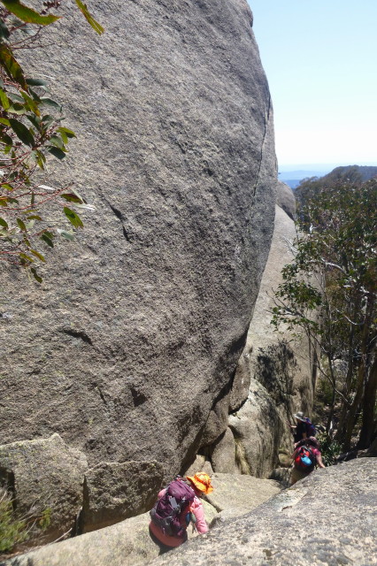
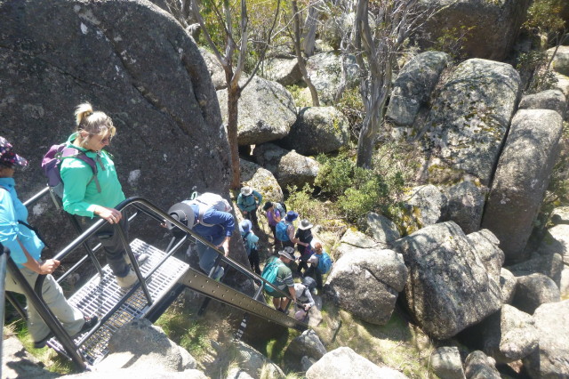
Once we reached the Rocky Creek Track, a dirt road that leads to the reservoir, we headed in the opposite direction towards Eagle Point. It is at this point we have descended some 150m since we began the walk. After some six kilometres of total walking we reached the rock formation. The advantage of the final ascent is the sturdy ladders to assist you in reaching the summit of the imposing granite boulders. Mind you, the ladder steps are of a width and spaced best to suit someone who wears a child’s shoe size two.
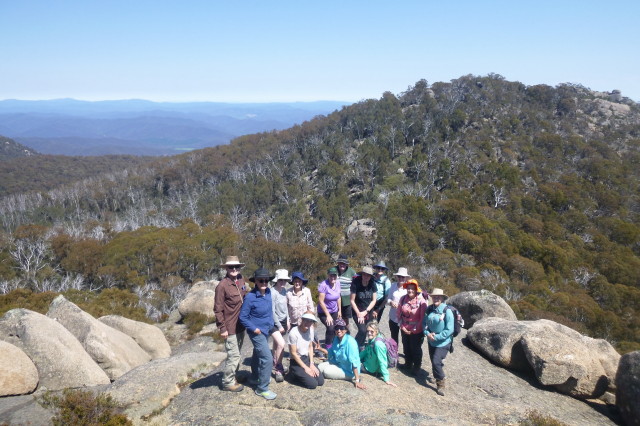
Eagle Point was our lunch spot at midday, with a cloudless sky above us. With an elevation of about 1470m a keen eye could see Winton Wetlands to the west, and Mount Cobbler to the south. Fellow walkers were a little concerned for Judy who appeared to be sitting precariously close to the edge, but she assured us she wasn’t. Although named Eagle Point, I am sure that Judy can’t fly.
After lunch and a group photo, it was time to head to the next rock formation, Og, Gog & Magog. I believe the name of this impressive granite feature may have been derived from an old biblical law firm. We have often walked this trail between the two viewpoints, but not in this direction. After this pleasant and shaded trail, we reached our necessary junction. A little more effort with some minor rock scrambling to reach the view at the top is required. Our elevation of almost 1500m rewarded us with picturesque alpine scenery and expansive views of the Buffalo Plateau.
After some relaxing moments and welcomed edible snakes, it was time to leave. From here, it was a matter of retracing our route back to the cars. On our return a snake was spotted by some of the group. The sounds of birds and joyous frogs with the recent rainfall could be frequently heard. There was also the infinite number of ants you would become acquainted with should you stand still for too long.
Back at the track that leads to the reservoir, Ayesha and Sandi took the opportunity to refill their water bottles from a fast-flowing stream. Before you could say, “oops, oh no, I have just lost my wide brimmed hat in the fast-flowing stream”, that’s exactly what happened. So, next time you are at the reservoir, and happen to spot a wide brimmed hat floating by, it belongs to Ayesha.
It was a fantastic day of walking in ideal conditions. Our 13.88km (or 138,800 decimetres) hike was completed in 6 hours and 20 minutes, once the final group arrived back at the cars just after 4pm.
Michael Braendler


